
Ireland is set for a major warm-up next week, with temperatures potentially reaching 24C before a powerful storm system developing in the Atlantic brings a more unsettled turn.
High pressure is expected to build over the country, with winds moving around to a southerly or southeasterly direction and temperatures climbing into the low to mid-20s.
Cathal Nolan from Ireland’s Weather Channel said Monday could see temperatures reach 24C in some areas.
He said: ‘We could see temperatures up into the 20s indeed, potentially up to 24C as we go through Monday itself.

‘Maybe even a fraction higher north of high ground in one or two low-lying areas.
‘Something to keep an eye on but it will feel pleasantly warm on Monday.’
The warm spell is expected to continue into Wednesday, although Tuesday will be cloudier with showers and more persistent rain developing across parts of the west and north.
Cathal said: ‘Into Tuesday we hold on to the mostly dry conditions as high pressure sits here just to our southeast but also to our west.
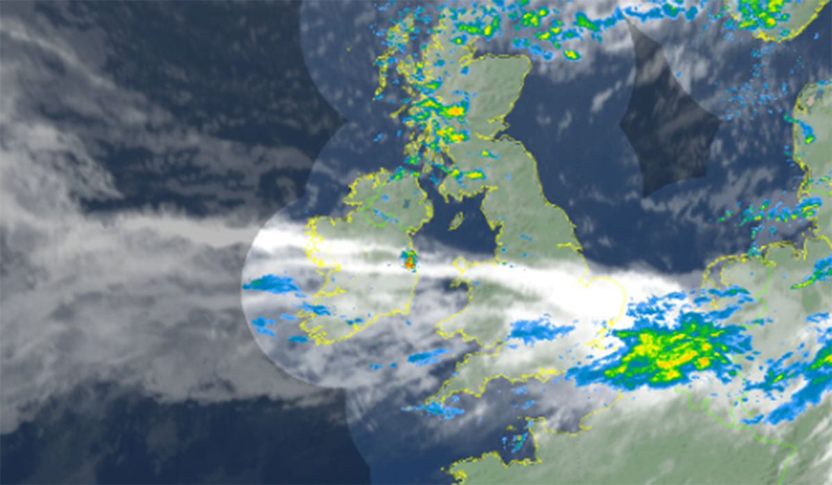
‘We have this cold front lying somewhere between the two so potentially a cloudier day overall on Tuesday with the risk of some outbreaks of rain into Connacht and West Ulster.
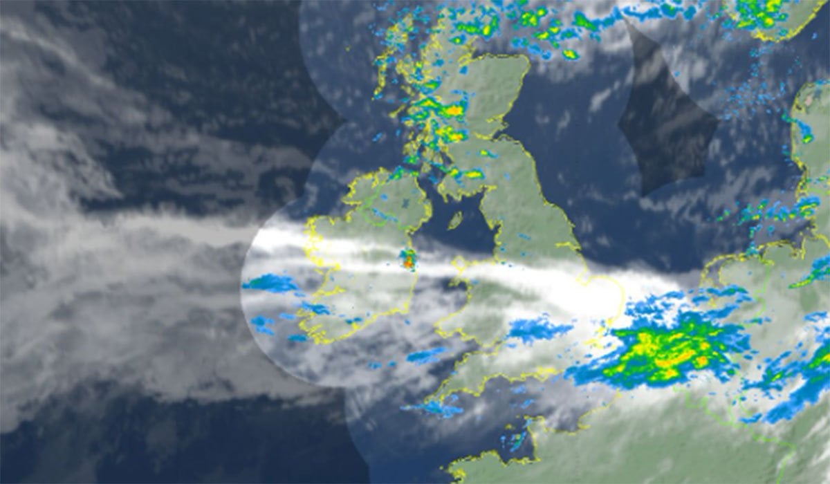
‘Becoming more widespread through the late evening and overnight and there’s a possibility that one or two showers along that line could become thundery in nature.’
Wednesday could then bring another pleasant spell, with the rain clearing during the morning before drier and brighter conditions develop.
Cathal said: ‘The time we get into Wednesday we see high pressure returning, delivering a pleasant and sunny day across the country with temperatures back into the 20s.’
Storm threat looms
However, the weather could take a significant turn later in the week.
Met Éireann said current indications suggest that ‘unsettled weather will return’ on Thursday, with some ‘wet and possibly very windy conditions’ on the cards.
There is also uncertainty surrounding a storm depression developing in the Atlantic and how far east it will track.

Cathal said there are ‘some question marks’ over the system, explaining that different weather models are currently showing different outcomes.
He said: ‘It’s not going to impact us, let’s say, overly directly. It’s going to miss us and push up towards Iceland but the ECMWF are in disagreement as to how far to the east it goes.”
For now, the forecast points to a notably warm start to next week, with temperatures potentially hitting 24C before conditions become more unsettled towards Thursday.