Parts of Waterford could be underwater in less than 100 years according to a new report.
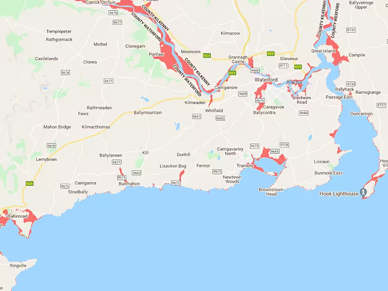
Climate Central has published sea level rise and coastal flood maps based on peer-reviewed scientific journals.
The report found that no coastal town in the country would be able to escape flooding in the next 80 years.
In Waterford City, a large section spanning from the bridge to Ballindud could be flooded by 2100, according to the Climate Central Map.
While permanent flooding could be on the cards along the Suir impacting Portlaw severely.
In Tramore, the map foresees the entire sand dunes to have subsided along with the prom.
While Annestown and Bunmahon are also among the areas Climate Central expects to be flooded.
In Dungarvan, the group foresees Clonea Beach, the Gold Coast Road and Abbeyside to be underwater.
The report states that the maps will include some error, however should be regarded as screening tools to identify places that may require deeper investigation of risk.
NOTE: LINK TO MAP HERE:


