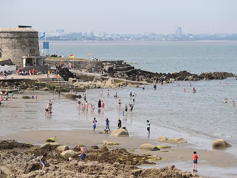

After a record-breaking heatwave in some parts of Ireland, Met Éireann is forecasting more sunshine and high temperatures on Sunday before an unsettled week of weather.
The forecaster said Sunday will bring good sunny spells with just a few scattered heavy or thundery showers developing in the afternoon.
Temperatures will reach highs of 22 to 26 degrees Celsius generally, though in parts of the midlands they could top 28 degrees.
Sunday night will be mostly dry with good clear spells, and lowest temperatures of 11 to 15 degrees.
However, the week ahead will see cooler and more unsettled conditions move in with temperatures back to more average values for mid-summer.
It will feel less humid on Monday, Met Éireann said, and there will be a fair amount of cloud around, with showery outbreaks of rain developing during the day. Temperatures are expected to range between 18 to 23 degrees.
Tomorrow, Sunday, will bring good sunny spells 🌤️ with just a few scattered heavy ☔️ or thundery showers developing in the afternoon. ⛈️
Warm or hot with highs 🌡️ of 22 to 26°C generally but reaching up to 27 or 28°C in parts of the midlands. 📈 https://t.co/9gKN6SVok4 pic.twitter.com/Akp3PTds8y— Met Éireann (@MetEireann) July 24, 2021
Record-breaking heatwave
The change in the weather comes after a record-breaking heatwave across the island.
The highest temperature of the year so far was recorded on Wednesday, with 30.8 degrees recorded at Mount Dillon, Co Roscommon.
In the North temperatures reached 31.4 degrees at Armagh, making it the third time in a week that the highest temperature record was broken in Northern Ireland.
At least 11 weather stations reached heatwave criteria across Ireland this week, with temperatures reaching at least 25 degrees for seven days in a row.
On Wednesday and Thursday night the temperature did not fall below 20 degrees at Valentia Observatory, Co Kerry – making it the first time Ireland has recorded a Tropical Night two nights in a row.
Last night was provisionally the first tropical night in Ireland for 20 years, with Valentia in #Kerry not observing any temperature under 20.5°C
Tropical nights (shaded air 🌡️ above 20°C all night) are rare in Ireland having only occurred around 6 times in the digital record. pic.twitter.com/3f7jMHECNb— Met Éireann (@MetEireann) July 22, 2021
Tropical Nights, when the shade air temperature is above 20 degrees all night, are a rarity in Ireland, having only occurred around six times in the digital record.
Another Irish weather record was broken at sea. The air temperature on the M2 buoy in the Irish Sea reached a maximum of 22.8 degrees on Wednesday evening, a record air temperature for the Irish Marine Data Buoy Observation Network.
The previous record of 22.5 degrees was recorded at M5 Buoy on July 12th, 2013.
Jet stream and climate change
Met Éireann said the heatwave was caused by a shift in the North Atlantic jet stream, which started to migrate northwards and is now displaced to the far north of the island.
This allowed the “Azores High” – a near permanent area of high pressure usually positioned in the sub-tropical Atlantic near the Azores Islands – to build north and steer warm, dry and settled conditions over Ireland.
This weather pattern brought warm air up from the south, and that, together with plenty of strong summer sunshine, allowed temperatures to build, with temperatures exceeding 30 degrees in some parts.
Climate change is already increasing the frequency and intensity of extreme events, and many single events have been shown to have been made worse by increasing temperatures.
Met Éireann said the latest climate projection models for Ireland show a trend towards warmer, wetter winters and hotter, drier summers as we move toward mid-century.